
Vis Archipelago — interactive map
An interactive add-on for existing destination and accommodation websites, bringing island discovery, practical information and personal trip planning together.
Interactive add-on · development project
A new function for an existing website
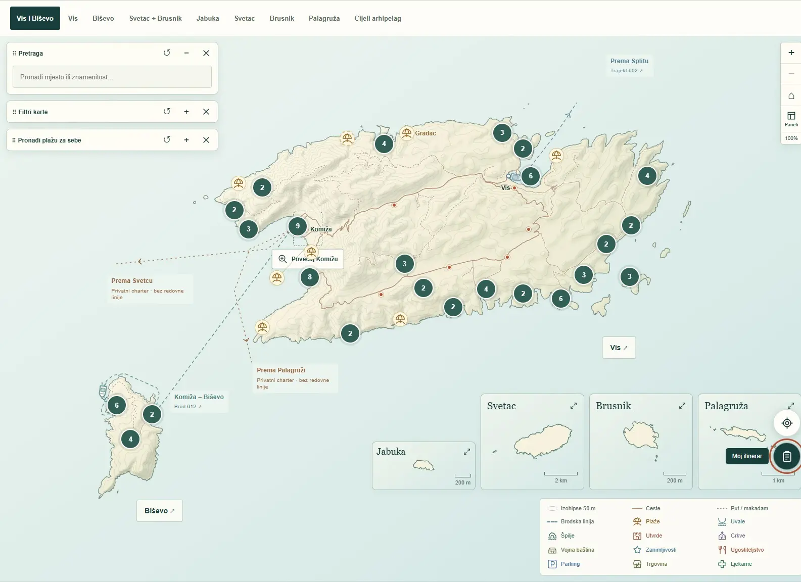
A destination website can introduce an island well and still leave visitors wondering where a place is, how to reach it and what fits into a single day. The interactive map of the Vis Archipelago brings those details together in a practical space for discovery and trip planning.
It is designed to complement an existing website, not replace it. Visitors can move from a destination story to a specific location, check practical details and create their own plan. This case study presents a development version through eight slides and screenshots of the working interface.
Open the presentation (Croatian)
From a location to useful information
The map connects Vis and Biševo with separate views of the more distant islands. Location cards bring photos and descriptions together with available information about access, beach surface, shade and parking. Visitors can save favourites, share locations or add them to an itinerary.
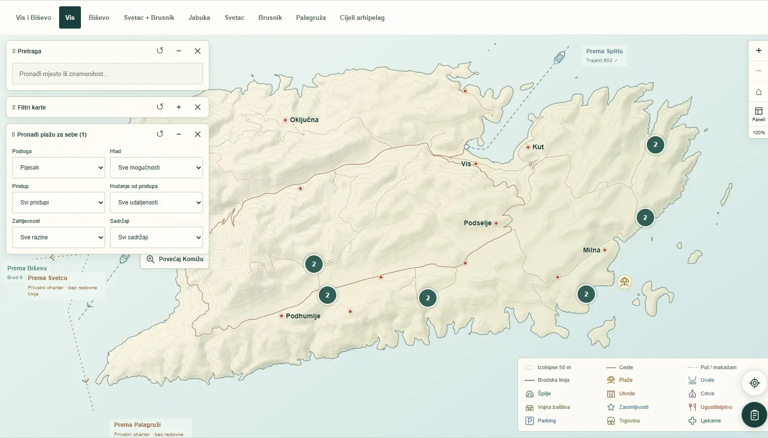
Beach filters help visitors narrow their choice by practical needs, such as a sandy surface or type of access. Results depend on the information entered, so local content verification remains an important part of development.
A personal plan rather than a fixed tour
Visitors organise places by day, change the order and length of visits, and add their own activities. The itinerary is linked to a route on the map and can be shared by link or downloaded as a PDF. A separate arrival view explains the journey from Split airport and port to Vis and an island destination.
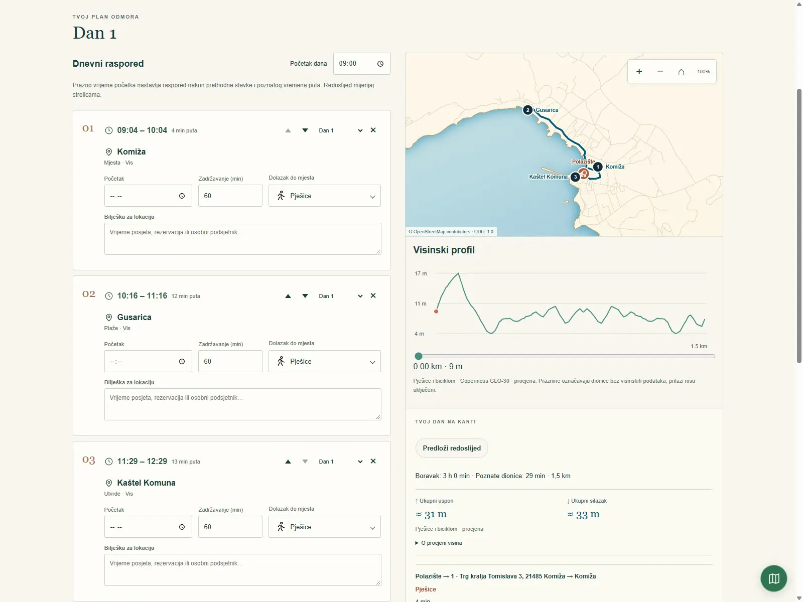
Routes, elevation profiles and travel times are indicative, not navigation instructions. The arrival view is not live transport tracking; current departures must be checked with the operator.
An add-on that can grow with the destination
The browser-based interface works on mobile devices and supports Croatian and English. Proposed ways to connect it with existing websites and guest materials include links and QR codes. These arrangements would be agreed with each partner; they are not an established partner network.
The proposed next step is a small pilot: choose an initial set of locations, verify the content with local sources, and gather visitor feedback. Clear responsibilities for maintaining information and reporting changes are just as important as the interface. The presentation therefore combines existing features with a proposal for collaboration.
Result
An interactive tool for location discovery and trip planning has been developed. A presentation of its features is publicly available here; a pilot and collaboration with local partners are proposed next steps.